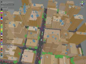
AgileView’s synthetic data had an 86% accuracy score while saving 80% of the time and cost associated with real image procurement and preparation.
— Charles Cleveland
NEW YORK, NY, USA, December 14, 2023 /EINPresswire.com/ — AgileView announced today new research demonstrating its synthetic data enables significantly faster, more economical machine learning models of satellite imagery than models trained with real images alone.
The study, comparing AgileView’s machine learning training accelerator to real satellite imagery, determined AgileView’s synthetic data had an 86% accuracy score while saving 80% of the time and cost associated with real image procurement and preparation. Expanding the study by adding 10% real imagery increased AgileView’s accuracy score to 95%.
“Our synthetic data software tools help expedite critical decision making for those who rely on overhead imagery,” said Avi Lindenbaum, CEO of AgileView. “What used to require thousands of hours of manual effort by humans can now be accomplished in a fraction of the time and cost using our synthetic data and training methodologies.”
Most of the cost and difficulty of artificial intelligence model development goes toward training the model to correctly interpret data inputs to accomplish specific tasks – for instance, correctly identifying objects in satellite or drone imagery. For models using real satellite data, procuring enough varied and annotated training imagery is difficult, costly and time consuming. AgileView’s technology generates synthetic data that mimics the features of real imagery, thereby accelerating object detection and classification by the model.
“Whether it’s identifying an enemy bomber or an oil spill, the ability to see and understand overhead imagery faster with greater clarity provides a vital decision-making advantage,” said retired Army Maj. Gen. Charles Cleveland, former director of operations of the National Geospatial-Intelligence Agency, and newly appointed member of AgileView’s advisory board. “Synthetic data has the potential to revolutionize how we address complex national security challenges and I look forward to helping AgileView shape the future of this important field.”
Founded in 2022, AgileView’s leadership includes Peter Marx, former CTO of the City of Los Angeles, and Keith Barber, a former senior executive at Planet and the National Geospatial Intelligence Agency. A member of the Department of Defense Tradewinds Marketplace, AgileView’s technology is designed to support the U.S. defense and intelligence communities, as well as energy, utilities, agriculture, and insurance markets.
About AgileView Inc.
AgileView provides synthetic data generation solutions tailored to improving overhead imagery analysis for decision making. Our mission is to bolster our customers’ efforts in unlocking the value of satellite and drone imagery by providing the tools to develop and deploy more accurate and cost-effective AI/ML models.
###
Avi Lindenbaum
AgileView Inc
+1 917-677-1805
media@AgileView.ai
![]()
Article originally published on www.einpresswire.com as AgileView Study Results Yield 80% Time and Cost Savings in Satellite Imagery Machine Learning


